Trails that combine unique landscapes and pristine nature: that’s trekking in southern Chile. From ancient forests to glaciers and mountains, each route reveals ecosystems, volcanoes, rivers, and lakes.
We’ve gathered 10 routes of varying difficulty and duration so you can discover the fascinating nature of our territory. It’s not science fiction, it’s walking through Chile.
1. Piedra del Águila Trail in Nahuelbuta National Park
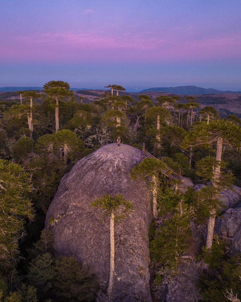
A spectacular trail among ancient araucaria trees that rewards you with a magical view. Upon reaching the summit of Piedra del Águila, at 1,400 meters altitude, you’ll enjoy a 360° panorama: on one side stretches the Pacific Ocean and on the other, the imposing mountain range of the Andes.
How to get there?
To visit this trail, the nearest terminal is La Araucanía International Airport (ZCO) in Temuco. From there, travel to the city of Angol and take route R-86 toward the mountains.
- Distance: 7 kilometers round trip
- Duration: 2–3 hours
- Difficulty level: Medium
- More information here.
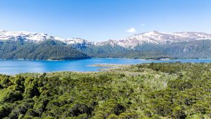
2. Sierra Nevada in Conguillío National Park
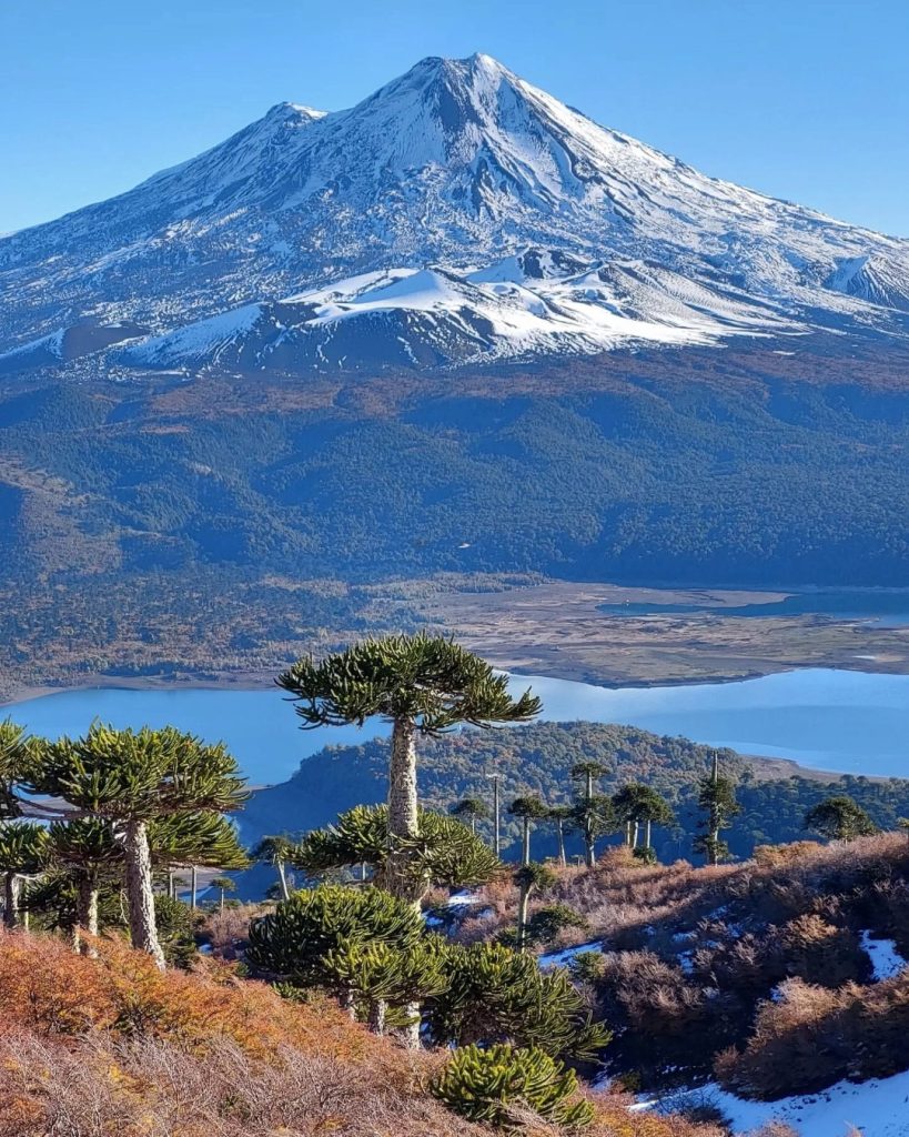
This trail is one of the most impressive in La Araucanía and is especially fascinating during autumn. The route borders Lake Conguillío and offers views of Llaima Volcano, one of Chile’s most active. The contrast between the lenga forests and the black lava fields creates a unique landscape that seems from another planet.
How to get there?
For this route, the nearest terminal is La Araucanía International Airport (ZCO) in Temuco. From there, travel about 110 km toward Curacautín or Melipeuco to reach the Laguna Conguillío sector.
- Distance: 10 kilometers round trip
- Duration: 5-6 hours
- Difficulty level: Medium
- More information here.
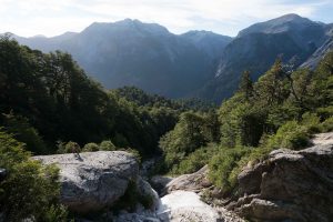
3. El Cañi Sanctuary in Pucón
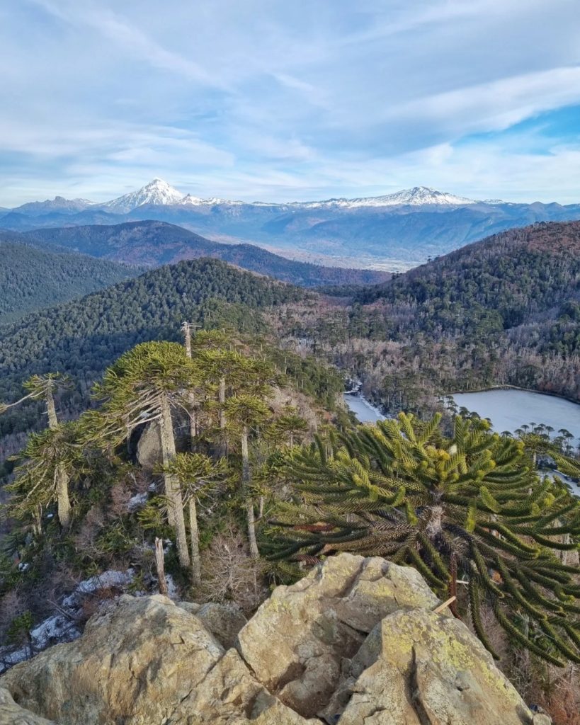
20 kilometers from Pucón, El Cañi Sanctuary is a private reserve known for its panoramic views of the lake district. This trek in southern Chile crosses forests of coigües, lengas, and araucarias, opening toward volcanic lagoons as you gain elevation. Its highlight is the Melidekiñ Viewpoint, at 1,550 meters altitude, from where you can observe the Villarrica, Llaima, and Lanín volcanoes.
How to get there?
To visit this sanctuary, the nearest terminal is La Araucanía International Airport (ZCO) in Temuco. From there, travel 125 km to Pucón and then take a bus or vehicle toward the Huife sector.
- Distance: 14 kilometers round trip
- Duration: 6–8 hours
- Difficulty level: Medium–High
- More information here.
4. Los Lagos Trail in Huerquehue National Park
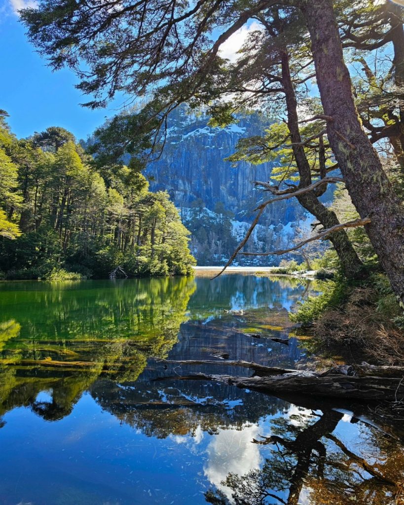
Famous for crossing crystal-clear lagoons and ancient forests, the Los Lagos Trail in Huerquehue National Park ventures into the mountains of La Araucanía. The route begins with views of Lake Tinquilco and ascends through forests of coigües and centuries-old araucarias, reaching a plateau where you’ll find Chico, Toro, and Verde lagoons.
How to get there?
To reach Huerquehue National Park, the nearest terminal is La Araucanía International Airport (ZCO) in Temuco. From there, travel 135 km to Pucón, a city located 32 km from the entrance via the Paillaco sector.
- Distance: 13 kilometers round trip
- Duration: 7–9 hours
- Difficulty level: Medium
- More information here.
5. Trail to La Junta in Cochamó Valley
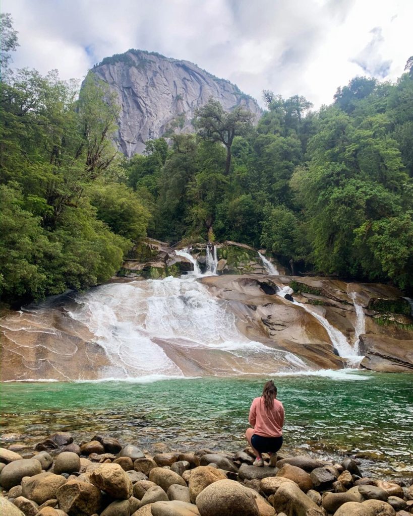
Cochamó Valley, in the Los Lagos Region, is known for its rainforests and enormous granite walls that have earned it the name “Chilean Yosemite.” The trail to La Junta follows old cattle-herding paths, crossing mud, rivers, and alerce forests.
During the hike you’ll encounter lush vegetation and irregular trails, typical of a pristine and minimally disturbed area. From La Junta you can access the famous natural water slides, one of southern Chile’s most iconic sights.
How to get there?
To visit this valley, the nearest terminal is El Tepual Airport (PMC) in Puerto Montt. From there, travel 115 km to the town of Cochamó and continue 5 km to the El Registro sector.
- Distance: 26 kilometers (round trip)
- Duration: 10-12 hours (spending one night in La Junta is recommended)
- Difficulty level: High (especially due to mud and roots)
- More information here.
6. Cascadas Escondidas in Pumalín Douglas Tompkins Park
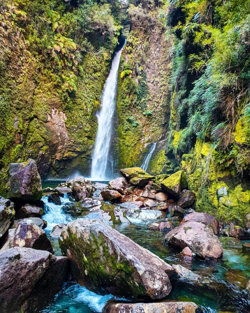
In the northern part of the Carretera Austral, Pumalín Douglas Tompkins National Park is the great symbol of nature conservation in our country. Among its extensive routes, the Cascadas Escondidas trail offers a short but demanding hike. The route provides access to three hidden waterfalls: the first is reached after a 25-minute climb, while the following ones are found after a flatter section, about 30 minutes away.
How to get there?
For this route, the nearest terminal is El Tepual Airport (PMC) in Puerto Montt. From there, follow the Bimodal Route south, which involves crossing the ferries from Hornopirén to Caleta Gonzalo before reaching the park. We recommend hiring a tour registered with Sernatur.
- Distance: 3.6 kilometers round trip
- Duration: 2–3 hours
- Difficulty level: Medium-High
- More information here.
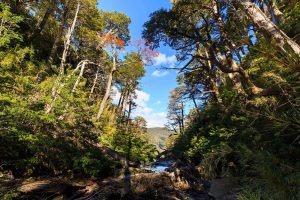
7. El Tepual Trail in Chiloé National Park
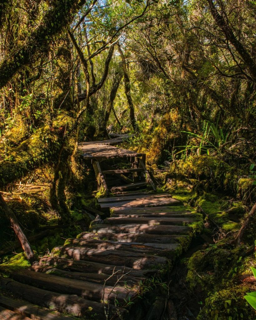
Located in Chiloé National Park, this trail is one of the best ways to experience the biodiversity of this magical Chilean island. You’ll venture into a temperate rainforest dominated by dense vegetation, ferns, and tepúes. Thanks to its wooden walkways, you can easily move through its flora and fauna, with the possibility of spotting the famous Darwin’s frog.
How to get there?
To visit this trail, the nearest terminal is Mocopulli Aerodrome (MHC) in Castro. From there, travel about 55 km to the Cucao sector by taking a bus from the city’s municipal terminal.
- Distance: 1 kilometer
- Duration: 1–2 hours
- Difficulty level: Easy
- More information here.
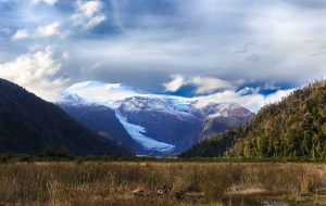
8. Hanging Glacier Viewpoint in Queulat National Park
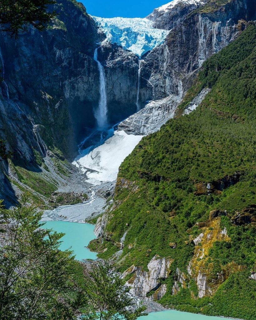
This route in Queulat National Park is one of the great highlights of the Carretera Austral. Located 165 kilometers from Coyhaique, the trail crosses a humid evergreen forest until reaching the Hanging Glacier viewpoint.
From here, a unique natural spectacle unfolds: a glacier suspended between mountains, from which waterfalls descend toward a turquoise lagoon, creating an unforgettable scene.
How to get there?
To reach this viewpoint, the nearest terminal is Balmaceda Aerodrome (BBA) in Coyhaique. From there, travel about 220 km north on the Carretera Austral to 20 km before reaching Puyuhuapi.
- Distance: 6 to 6.5 kilometers round trip
- Duration: 3–4 hours
- Difficulty level: Medium
- More information here.
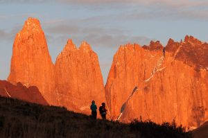
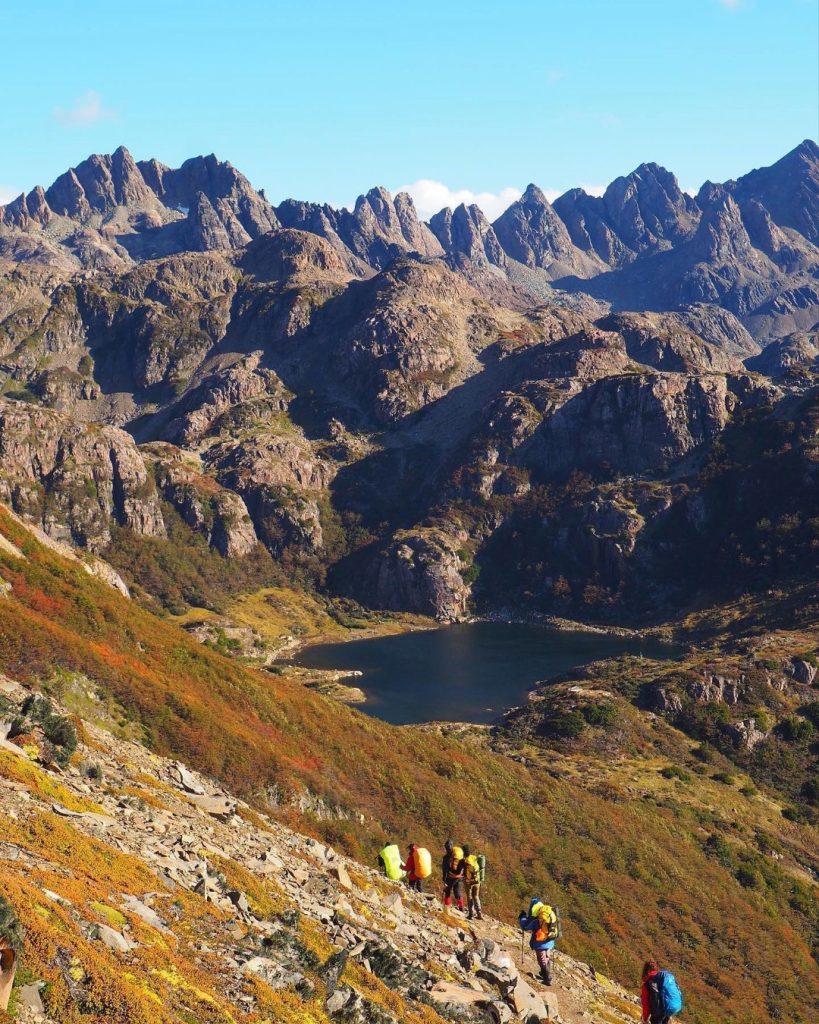
9. Las Horquetas Trek in Cerro Castillo National Park
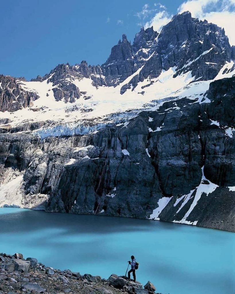
This circuit in Cerro Castillo National Park offers an isolated and authentic mountain experience on the Carretera Austral. The route circles the Cerro Castillo massif, characterized by its sharp granite spires, glaciers, and lagoons of turquoise color.
Along the route, you can observe condors, cross lenga forests, and traverse glacial valleys where nature remains virtually untouched. You might even spot the magnificent huemul.
How to get there?
For this trek, the nearest terminal is Balmaceda Aerodrome (BBA) in Coyhaique. From there, travel just 55 km south on the Carretera Austral to the marked stop in the Las Horquetas sector.
- Distance: 55 kilometers total
- Duration: 4–5 days
- Difficulty level: High
- More information here.
10. Dientes de Navarino Circuit at the End of the World
It’s the southernmost trek on the planet. The Dientes de Navarino Circuit begins in Puerto Williams, Magallanes Region, and offers one of Chile’s most extreme and remote experiences. The route crosses landscapes of peat valleys, jagged mountains, and extreme weather.
This is a demanding circuit, recommended only for those with experience, due to the weather conditions and terrain difficulty. The best time to do it is during the months of December to March.
How to get there?
For this circuit, first travel to Punta Arenas and connect to Puerto Williams by plane or ferry. Once in the town, simply walk to Plaza de la Virgen, where the ascent to the mountain range begins.
- Distance: 53 kilometers
- Duration: 4–6 days
- Difficulty level: Very high
- More information here.